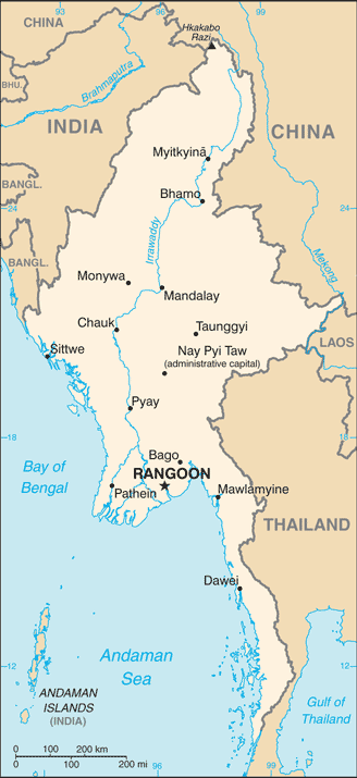
Burma, officially the Republic of the Union of Myanmar, is the second largest country in Southeast Asia. It is bordered by India, Bangladesh, China, Laos and Thailand. One-third of Burma’s total perimeter of 1,930 km forms an uninterrupted coastline along the Bay of Bengal and the Andaman Sea.
Hkakabo Razi, located in Kachin State, at an elevation of 5,881 m, is the highest point in Burma. Three mountain ranges, namely the Rakhine Yoma, the Bago Yoma, and the Shan Plateau exist within Burma, all of which run north-to-south from the Himalayas.
The mountain chains divide Burma’s 3 river systems, which are the Irrawaddy, Salween (Thanlwin), and the Sittaung rivers.
The Irrawaddy River, Burma’s longest river, nearly 2,170 km long, flows into the Gulf of Martaban. Fertile plains exist in the valleys between the mountain chains.
The majority of Burma’s population lives in the Irrawaddy valley, which is situated between the Rakhine Yoma and the Shan Plateau.
A largely rural, densely forested country, Burma is the world’s largest exporter of teak and a principal source of jade, pearls, rubies and sapphires. It is endowed with extremely fertile soil and has important offshore oil and gas deposits.