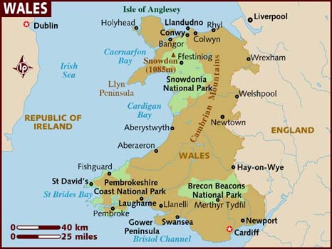
Wales (Welsh: Cymru) is a country on the western side of central southern Great Britain, between the Irish Sea to the north and the Bristol Channel to the south. It is part of the United Kingdom, and is bordered by England to its east and the Atlantic Ocean, St George’s Channel and Irish Sea to its west.
It is about 274 km from north to south and at least 97 km wide, with a total area of 20,779 km2. It has over 1,200 km of coastline, and includes over 50 offshore islands of which the largest is Anglesey.
Much of Wales is mountainous, particularly in 3 main regions: Snowdonia in the north west, the Cambrian Mountains in mid Wales, and the Brecon Beacons in the south. Snowdonia contains the highest peaks, topped by Snowdon (Welsh: Yr Wyddfa) at 1,085 m. The 14 peaks over 3,000 feet are known collectively as the Welsh 3000s.
There are only 5 cities in Wales. Cardiff is the capital and largest city. The next largest cities are Swansea and Newport, also in the south of the country. The other cities are Bangor and St David’s.